During the 2024 hurricane season, La Nina has not yet appeared in the Pacific Ocean but may be forming in the Atlantic Ocean.
Researchers still need to collect temperature data throughout August to determine whether La Nina actually forms over the equator in the Atlantic, but this summer has been unusual – The Hill quoted Franz Philip Tuchen, a postdoctoral fellow at the Cooperative Institute for Marine and Atmospheric Research, as saying.
The year 2024 started with record high sea surface temperatures, reaching 30 degrees Celsius, then cooled quickly and suddenly. Tuchen said the pattern was more dramatic than any previous year.
“It’s almost unprecedented in the time series over the past 40 years,” he said.
If Atlantic sea surface temperatures stay the same around June and July, it will officially form La Nina in the Atlantic.
Unlike La Nina patterns that have repeatedly occurred in the Pacific in recent years, La Nina has not appeared in the Atlantic in more than a decade. Tuchen said the last time La Nina appeared in the Atlantic was in the summer of 2013.
One major difference between Pacific and Atlantic La Nina is the extent of their impact. While La Nina in the Pacific impacts weather globally, including across the United States, “everything is a little smaller” with La Nina in the Atlantic, Tuchen explained. They don’t last long and really only have an impact on the weather in the area.
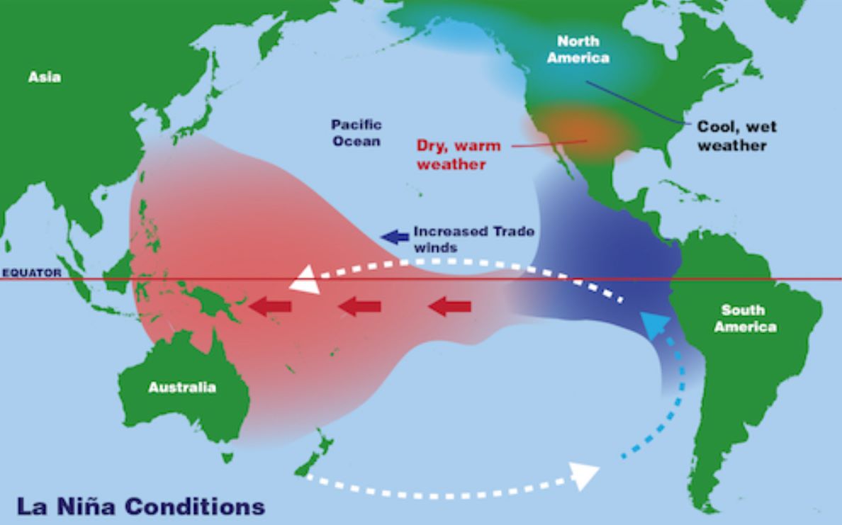
A strong La Nina would impact rain in northeast Brazil and western Africa – lands near the equatorial Atlantic – but not in the US.
Meanwhile, La Nina in the Pacific typically means drier, warmer-than-average conditions across the southern half of the U.S., more precipitation in the Pacific Northwest and Ohio Valley, and warmer weather. Extremely cold weather in the northern states. It can also create strong storms.
That La Niña pattern is expected to form this fall and strengthen heading into winter.
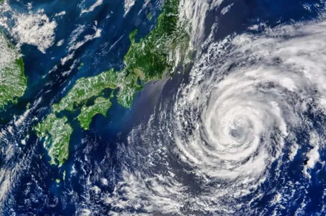
La Nina is expected to have a major impact on storms in the East Sea and northwest Pacific from September onwards.
According to the Storm page in the Pacific Northwest, signs of La Nina have come closer in August, with the latest manifestation being that the cold water area in the eastern Pacific Ocean is expanding and spreading further towards the Pacific Ocean. Western Pacific.
The potential for La Nina to develop at the peak of hurricane season will have a major impact on the number of tropical storms that will develop.
The Philippine Atmospheric, Geophysical and Astronomical Services Administration (PAGASA) said that La Nina can cause storms to land faster. PAGASA warns that with storms closer to land, there will be less time to prepare.


 Ex ni Kyline Alcantara na si Kobe, BINISTO ang lahat sa publiko—Lahat ng Baho Isiniwalat