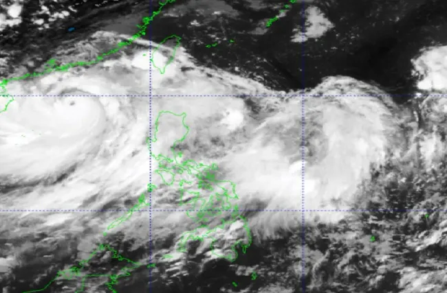
PAGASA is closely monitoring two weather disturbances that may enter the Philippine monitoring area in the next 2 weeks and are expected to develop into storms.
Mr. Benison Estareja – weather expert with the Philippine Atmospheric, Geophysical and Astronomical Services Administration (PAGASA) – said a low pressure area may form in the eastern part of Luzon island between this weekend and September 9. This weather disturbance is expected to move northwards, entering the Philippines towards the northeast of the country.
The weather disturbance will be given the local name Ferdie if it develops into a tropical storm while located within the Philippine Area of Responsibility (abbreviated as PAR – the area in the Pacific Northwest where PAGASA monitors the phenomena weather).
A second low pressure area is expected to form southeast of Guam, move west and enter the Philippine Watch Area as a typhoon. According to Mr. Estareja, this potential weather disturbance will move into PAR next weekend and could strengthen into a tropical storm named Gener.
Estareja said the expected path of these potential weather disturbances could still change.
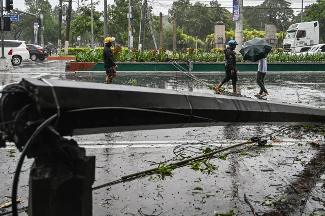
Meanwhile, Filipinos are still overcoming the consequences caused by Typhoon Yagi. The number of deaths due to this storm has reached 16 people, more than 2 million people are affected.
Philippine Government data shows that over P63 million in infrastructure damage and over P1 million in agricultural damage were reported.


