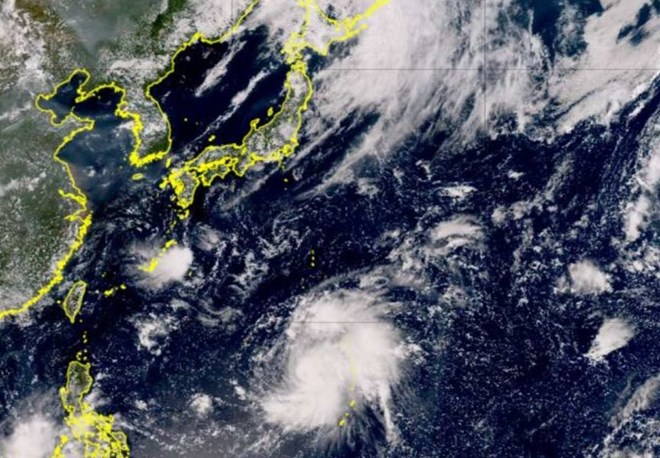
According to the latest storm news, after leaving the Philippines, storm Shansha continued to intensify, becoming a hurricane.

The Japan Meteorological Agency (JMA) warned people in western Honshu and Shikoku to prepare for heavy rain and strong winds, and forecast Typhoon Shansha to approach these areas early next week.
On August 23, storm Shanshan continued to move north from the western Mariana Islands. The storm – forecast to strengthen into a hurricane today (August 24) – has a central pressure of 985 hectopascals, with maximum sustained winds of 108 km/h, gusts of up to 162 km/h. h.
The JMA’s storm forecast shows that Typhoon Shanshan will strengthen as it moves towards Japan. By the afternoon of August 24, the storm is expected to have a central pressure of 975 hectopascals, with sustained winds of up to 126 km/h and gusts of up to 180 km/h.
By the afternoon of August 25, the storm is expected to strengthen further, with sustained winds of up to 144 km/h and gusts of up to 216 km/h.
After moving north, storm Shanshan is forecast to turn west, move northwest until the morning of August 27 and maintain intensity. The storm is then predicted to turn northeast, approaching or making landfall on the islands of Honshu or Shikoku early on the morning of August 28, potentially maintaining at storm intensity before weakening as it moves inland.
Authorities are encouraging people near the storm’s expected path to prepare for strong winds and heavy rain as well as the possibility of lightning strikes, mudslides and flooding.
Even areas on the storm’s eastern flank, away from the storm’s center, could face adverse weather as Shanshan approaches.
According to Weathernews, unstable atmospheric conditions due to a low pressure trough expected to move west of Japan and moist air due to the flow of air from the Pacific high pressure system make it difficult to forecast the path of the The storm becomes difficult. People in potentially affected areas are advised to closely monitor the trajectory of Typhoon Shanshan.


 Ex ni Kyline Alcantara na si Kobe, BINISTO ang lahat sa publiko—Lahat ng Baho Isiniwalat


