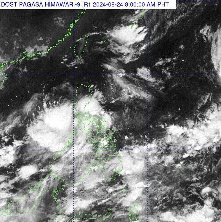
The latest storm and tropical depression forecast says a cloud cluster in the Mimaropa area, Philippines is expected to become a new low pressure area near the East Sea.
The Philippine Atmospheric, Geophysical and Astronomical Services Administration (PAGASA) said it is closely monitoring clouds that could develop into a new low pressure area near the South China Sea.
The clouds were spotted over the Mimaropa areas (Mindoro, Marinduque, Romblon and Palawan).
PAGASA weather expert Benison Estareja said: “We are closely monitoring the movement of these clouds. The clouds are forecast to develop into shallow convection or low pressure areas.”
PAGASA weather forecaster added that the trade winds blowing from the east across the Pacific Ocean carrying hot and humid air are affecting Southern Luzon and the eastern parts of Visayas and Mindanao.
“Scattered rains and thunderstorms are forecast in these areas throughout the day,” he said.
For Metro Manila and other parts of the Philippines, scattered showers or thunderstorms are expected.
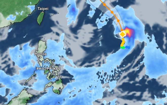
In its weather bulletin issued at 4 a.m. on August 24, PAGASA also reported that the storm originated from the area near the South China Sea, Shanshan.
The latest storm, Shanshan, is currently 2,055 kilometers east of central Luzon. The storm has maximum sustained winds of 110 kilometers per hour near the center, gusts of up to 135 kilometers per hour, and is moving north at a speed of 15 kilometers per hour.
Previously, at 3:00 p.m. on August 23, typhoon Shanshan was recorded 2,135 km east of Central Luzon. The storm moved slowly northward and had maximum sustained winds of 100 km/h and gusts of up to 125 km/h.
The latest storm information on August 24 from the Joint Typhoon Warning Center (JTWC) of the US Air Force and US Navy said that Shanshan – Japan’s 10th typhoon – was located 667 km south of Iwo To. The storm has been moving north at a speed of 11 km/h in the past 6 hours.
It is forecasted that typhoon Shanshan will continue to move northwest in the next 3 days. The storm is expected to make landfall on the 4th day from the forecast time and gradually weaken.
According to the New York Times, the hurricane season in the western Pacific occurs year-round, but most storms form from early July to mid-December.
Most of the storms that form in this region pass through or strike places like the Philippines, Japan and Taiwan (China) and have the potential to hit the Korean Peninsula, China and Vietnam, bringing strong winds and high waves.
Storms in the region also hit US territories, causing billions of dollars in devastating damage in places like Guam, which was hit by Super Typhoon Mawar last May.