According to the latest tropical depression and storm warnings, a Category 5 storm has been issued as it threatens the Caribbean islands.
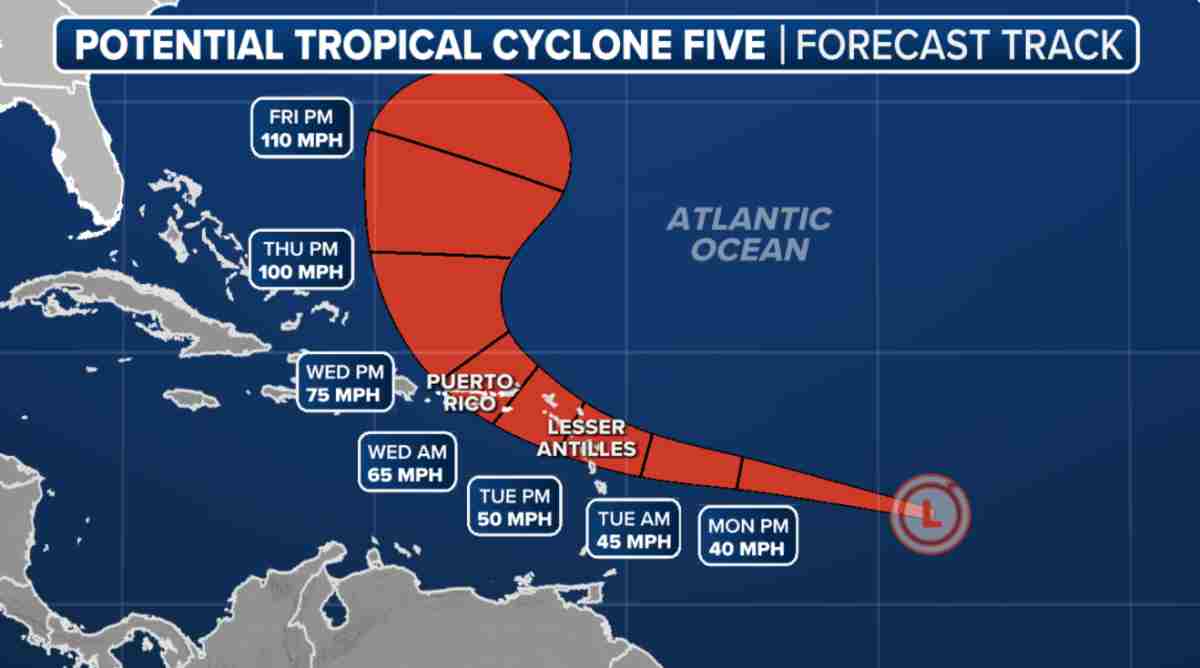
The 2024 Atlantic hurricane season is approaching its peak, and as expected, the storm formation zone is getting more active as the US National Hurricane Center (NHC) issued a potential tropical storm advisory for Tropical Storm No. 5, which is slowly forming east of the Leeward Islands.
The NHC’s 2 p.m. ET forecast on August 10 shows a low pressure system with a broad band of showers and thunderstorms that has been strengthening since August 7 and is currently located in the middle of the tropical Atlantic, roughly between the Cape Verde Islands and the Lesser Antilles in the Caribbean. The NHC gives a 40 percent chance of development over the next two days and an 80 percent chance over the next seven days.
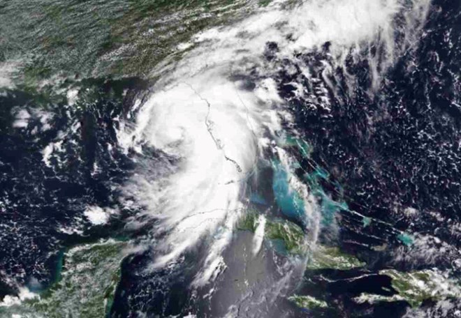
However, on August 11, the NHC announced that Hurricane No. 5 had formed in the Atlantic, earlier than previously forecast.
The tropics have been more active in recent weeks with the development of Hurricane Debby, which first made landfall in Florida (USA) and then made a second landfall in South Carolina as a tropical storm.
And soon after, Low Pressure Invest 98L began to form as it moved through the warm waters of the tropical Atlantic and eventually became the storm now known as Hurricane No. 5.
Since 2017, a potential tropical storm has allowed the NHC to issue routine advisories for a system that has not yet developed into a tropical depression or tropical storm but carries the threat of winds greater than 62 km/h (39 mph) making landfall within 48 hours.
This provision also allows for the issuance of tropical storm or hurricane watches and warnings for areas with the highest concern about the storm’s potential impact.
The NHC said the system has the potential to become Tropical Storm Ernesto before reaching the Leeward Islands.
Currently, a potential tropical storm number 5 is located in the tropical Central Atlantic.
Due to the threat that a potential tropical storm number 5 poses to the Leeward Islands, as well as the territories of Puerto Rico and the U.S. Virgin Islands, tropical storm warnings have been issued for Guadeloupe, St. Martin, St. Kitts, Nevis, Montserrat, Antigua, Barbuda, and Anguilla.
A tropical storm warning means tropical storm conditions are possible within two days.
According to the NHC, additional warnings or watches are likely for Puerto Rico.
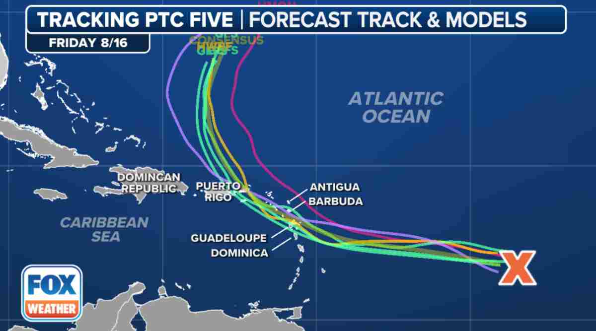
The NHC said potential tropical storm number 5 will continue to move westward as it moves through the tropical Central Atlantic before beginning to turn northwest near the Caribbean Islands.
Current models show the storm moving northward after approaching Puerto Rico.
The National Oceanic and Atmospheric Administration (NOAA) updated its hurricane forecast last week, predicting an extremely severe hurricane season with 17-24 named storms, of which 8-13 will be hurricanes. Of those, 4-7 will become major hurricanes.
The Atlantic hurricane season officially runs from June 1 to November 30.