According to the latest storm forecast, storm No. 5 Ernesto is expected to strengthen into a super typhoon on August 16.
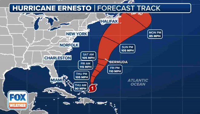
The latest hurricane information from the US National Hurricane Center (NHC) on August 15 said that Hurricane Ernesto – the fifth Atlantic hurricane of the 2024 hurricane season – is moving into the Atlantic Ocean and away from Puerto Rico. Hurricane Ernesto is currently located about 289 km east of Grand Turk Island.
Ernesto, currently a Category 1 hurricane on the Saffir-Simpson hurricane scale (winds of 119-153 km/h), will begin to turn north in the next day or two and eventually become a super typhoon.
Forecasts say the storm will become a Category 3 hurricane with winds of 185 km/h south of Bermuda tomorrow (August 16).
According to this forecast, the center of Hurricane Ernesto is expected to pass near Bermuda with winds of over 161 km/h.
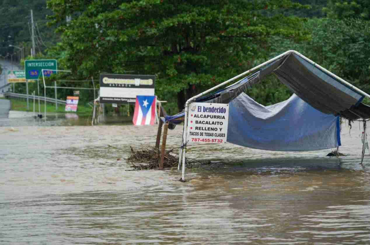
Hurricane No. 5 is expected to cause heavy rains, with an expected 80-150 mm, locally up to 230 mm. These rains can cause life-threatening flash floods.
A hurricane warning has been issued for Bermuda, meaning tropical storm force winds are possible within the next 48 hours. The Category 5 storm then moves toward the Canadian Maritimes, weakening as it passes over cooler waters.
Ernesto formed in the Atlantic on August 12 before impacting the Caribbean islands of St. Croix and Puerto Rico as a tropical storm.
A significant trough off the East Coast has long been predicted to act as a barrier, preventing the storm from making a direct hit on the United States, but not far enough to prevent indirect impacts on the coast.
Large swells were seen as early as August 15 in Florida, but are likely to persist through the weekend and early next week. The threat is considered significant enough that the National Hurricane Center has warned of the dangers in its advisories.
“Storm-generated surf is expected to hit coastal Florida this weekend and into the weekend. Beachgoers should be aware of the significant risk of life-threatening large swells and rip currents,” NHC forecasters said in a statement.
Rip currents form when water builds up and forms a narrow, fast-moving channel that can quickly sweep swimmers away from shore, often catching them off guard.
Rip currents can travel as fast as 86.4 km/h (2.4 m/s), faster than most people can swim.
Tropical storms such as Hurricane Beryl and Hurricane Debby earlier in the season have increased rip currents along some U.S. coastlines, but no deaths have been reported.
As of August 4, at least 30 people have died from rip currents or large waves across the United States, according to data from the National Oceanic and Atmospheric Administration (NOAA).
Most of the deaths have occurred in Florida, but beaches in Puerto Rico and the Carolinas have also seen a number of deaths.