According to the latest storm forecast, two low pressure areas near the East Sea are expected to form within the next week.
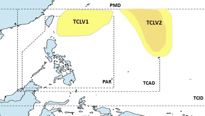
According to storm and tropical depression news on August 21 from the Philippine Astronomical, Geophysical and Atmospheric Administration, from now until August 27, 2024, a low pressure is likely to form inside the monitoring area (PAR). of the Philippines, in the northern part. This low pressure is unlikely to strengthen into a storm.
A second low pressure is likely to appear at the eastern boundary of the tropical storm monitoring area (TCAD) of the Philippines, with a low to moderate chance of strengthening into a storm.
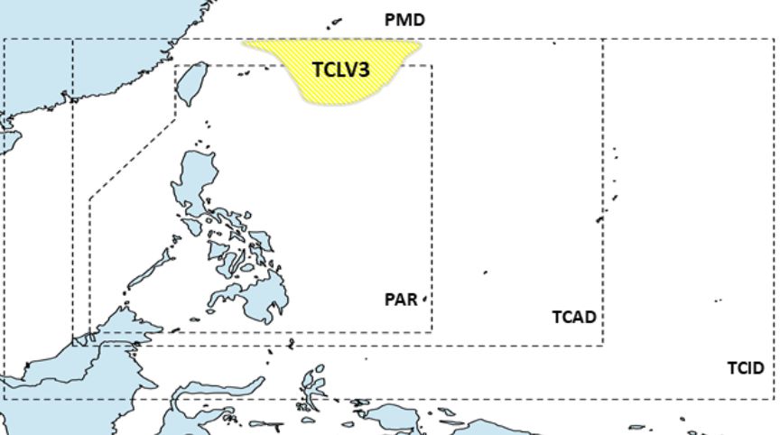
During the week from August 28 to September 3, 2024, the forecast shows that a third low pressure is likely to appear in the north of PAGASA’s monitoring area (PMD). This depression is less likely to develop into a storm.
However, any changes in the forecast model will be closely monitored and updates will be issued as necessary.
Meanwhile, the low pressure that PAGASA monitored on August 20 has left PAR and does not affect any area of the Philippines.
PAGASA’s weather forecast said that fine weather and scattered showers will prevail across the archipelago on August 22.
Rain mainly occurs in the afternoon or evening, due to local thunderstorms.
PAGASA also forecasts that easterly winds will bring scattered showers or thunderstorms in Eastern Visayas, Caraga and Davao.
Severe thunderstorms could cause flash floods or landslides, the agency added.
Light to moderate winds and light to moderate seas will occur across the archipelago, PAGASA noted.