

During the interview round of the 1994 Miss Universe Pageant, the presenter quizzed former Miss Philippines, Charlene Gonzales, about her home country’s geography.
“How many islands are in the Philippines?” asked American game show emcee Bob Goan. Without missing a beat, Gonzales quipped: “High tide or low tide?”
It’s a surprisingly tricky question. The Philippines’ official count currently sits at 7,641 islands. The tally does not include the thousands of shoals and sandbars that emerge during low tide, as a landform can only be classified as an island if it remains above water at all times.
But the fleeting nature of sandbars makes them all the more exciting to explore.
Though the Philippines is currently closed to international tourism due to the coronavirus pandemic, when travel safely resumes tourists can visit these disappearing sandbars if they plan ahead and time it perfectly with the tides.
“With so many little islands and peninsulas in the Philippines, the tides are hard to predict because the landmasses create a labyrinth for the water – it’s got to go left and right and up and down to make its way around them,” Søren Knudsen, the co-founder of not-for-profit organization Marine Conservation Philippines, tells CNN Travel.
“Even just 20 kilometers apart, the tides can be very different, depending on the topography. So if you want to visit a (disappearing) sandbar, you would need to consult the hyper-local tidal charts or travel with a local tourism operator.”
Putting sandbars on the map
Ervin Malicdem, a Filipino independent researcher and information technology professional, has been plotting many of the Philippines’ sandbars and other previously uncharted territory.
Malicdem, who founded Schadow1 Expeditions, a mapping and adventure platform, in 2012, has climbed mountains, chartered boats and biked countless trails as a volunteer researcher.
His efforts have not only helped bring tourists to far-flung areas but also improved local navigation, disaster responses and environmental initiatives.
“After mapping some of these places, they have become more famous and more accessible, more on the radar,” he says.
He points to Panampangan Sandbar, in the southernmost province of Tawi-Tawi, as a perfect example.
Malicdem turned a spotlight on this oft-overlooked destination in 2017 when he published a ranking of the 10 longest sandbars in the Philippines.
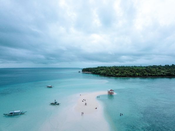
Panampangan topped the list, measuring 3.1 kilometers long in total. The sandy strip remains submerged most of the day, only peeking out at low tide.
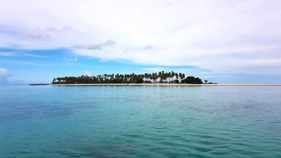
But when the white sand emerges from the turquoise water, it’s a sight to behold, with palm-fringed islands at either end.
“Before I published the study, most people wouldn’t have thought to go there, but now it’s more popular,” he says.
“There still aren’t a lot of private operators there, so you’d take a ‘habal-habal’ (motorcycle), tricycle or van from the airport (on Bongao island) to the provincial tourism office of Tawi-Tawi. They will provide you with a boat ride and all the information that you need.”
Easy-to-visit sandbars

Panampangan is the longest sandbar in the Philippines.
Schadow1 Expeditions
From north to south, east to west, the Philippines is home to thousands of vanishing sand bars, many of which travelers can explore.
For a relatively easy adventure, Knudsen recommends the Manjuyod Sandbar off the coast of Bais City on Negros Oriental in the Philippines’ central region.
Several tour operators offer small group tours and private day trips to the sandbar at low tide, where you can snorkel amongst technicolor reef fish and watch playful dolphins in the clear water.
Adventurous travelers can stay overnight in a rustic bungalow over the water. They’re spartan and peaceful, though guests need to bring their own sleeping bag, food, water, flashlights, batteries and supplies as there’s nothing else around.
“If you can imagine picture-perfect white sand underneath 10 inches of water – it was very, very pretty,” recalls Knudsen.
“I’d recommend combining a visit to the sandbar and some dolphin watching on the way there.”
Another relatively easy sandbar to reach is Manlawi Sandbar, part of the Caramoan Islands in the eastern Philippines, thanks to a long list of tour operators offering day trips or overnight excursions to this pristine sandbar.
“This one (Manlawi) is pretty famous already – and there is more infrastructure than most, so you can stay overnight at the jump-off point in Caramoan Town,” says Malicdem.
“On the sandbar, there are also these cool picnic huts that are tied to the sand. When it’s low tide, you dine on the sand; when it’s high tide you float in the water and you would have no idea there is a sandbar below you!”
Exploring farther afield
If you don’t mind a little more legwork, Malicdem says it’s worth concentrating on Palawan’s Balabac islands, where travelers can hop from sandbar to sandbar in one trip.
“In this group of islands, there are many sandbars because the sea is not too deep here,” explains Malicdem.
One of the most memorable, he says is the remote Queen Helen Sandbar of Sebaring Point on Bugsuk Island, one of the southernmost islands of Palawan.
“You really have to time this one right. During low tide, you’ll see a wide beach with sand so fine it feels like talcum powder,” he recalls.
“While you are waiting for the beach to emerge, you can hang out on the adjacent beaches which are equally beautiful. There are no private resorts here – it’s still pretty untouched.”
To the southwest of Queen Helen, you’ll find another vanishing beauty: Angela Sandbar, stretching about one kilometer off the coast of Mansalangan island.
“I love this sandbar because you get a 360-degree view of the Balabac archipelago in the Sulu Sea, which is really beautiful,” says Malicdem.
He also points to BenLen Sandbar, south of Candaraman Island in Palawan.
“My nickname is Ben, and the barangay (village) captain actually named this sandbar after me and my wife, since I mapped the area,” he says proudly.
“At high tide, it looks like a constellation of stars because of the many starfish that group on the sand.”


