The low pressure area near the East Sea is forecast to strengthen into a tropical depression and cause rain in the Philippines.
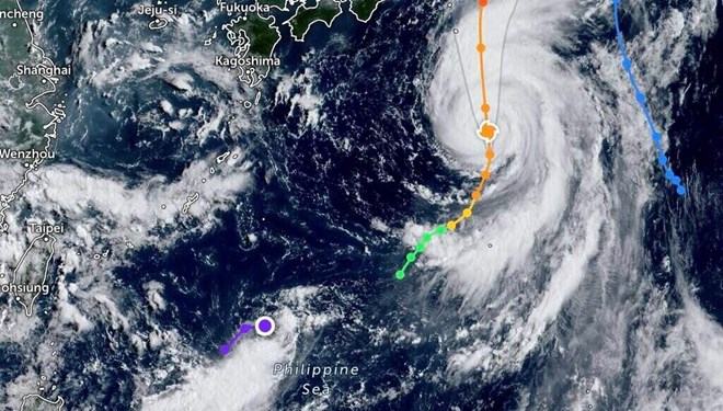
The latest storm and tropical depression information from the Philippine Atmospheric Geophysical and Astronomical Services Administration (PAGASA) on August 15 said that the low pressure area (LPA) detected off the coast of Northern Luzon, Philippines is likely to strengthen into a tropical depression in the next 24 hours but may also quickly leave the Philippine forecast area.
According to the latest storm and tropical depression information, the low pressure area near the East Sea is about 1,375km east of Northern Luzon, currently inside the Philippine forecast area.
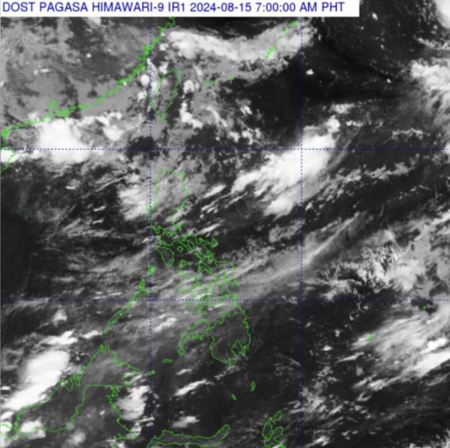
PAGASA weather forecaster Robert Badrina said the low pressure area is expected to be named “Dindo”.
For now, the PAGASA weather forecaster said the low pressure area near the South China Sea has no direct impact on the Philippines and the rainfall being recorded in some parts of the country is due to the southwest monsoon or “habagat”.
“Habagat is causing scattered and isolated showers and thunderstorms in many areas, including Metro Manila, the rest of Luzon and Western Visayas,” Badrina said in a 5 a.m. alert on August 15, the Manila Times reported.
According to the latest weather forecast from PAGASA, the remaining areas of the Philippines will record partly cloudy or partly cloudy skies due to localized thunderstorms.
Also related to the storm developments near the East Sea, the latest storm information from the Joint Typhoon Warning Center (JTWC) of the US Air Force and US Navy said that Ampil, the seventh storm of the western Pacific typhoon season, is 867km south of Yokosuka, Japan.
The storm has been moving north-northeast at a speed of 17 km/h over the past 6 hours. The latest storm forecast said that Ampil will continue to move north-northeast.
News
‘Philippines needs to balance economic growth, climate resilience’
Photos show the air quality in Quezon City and Pasig on August 19, 2024, as vog from Taal Volcano drifted across several areas. STAR / Michael Varcas MANILA, Philippines — The Philippines needs to balance economic growth and climate resilience…
Climate change warning reaches highest level
Using solar panels or other renewable energy sources lowers the carbon footprint, leading to reduced greenhouse gas emissions and decreased reliance on non-renewable energy. As we enter the typhoon season, recent extreme weather events have once again underscored the Philippines’…
‘Habagat’ to dampen parts of Philippines on Wednesday
Motorists and commuters endure the sudden heavy downpour along Taft Avenue in Manila on Aug. 10, 2024. The STAR / Ryan Baldemor MANILA, Philippines — The southwest monsoon or habagat is expected to bring occasional rains in several parts of the…
Southwest monsoon dumps rain in parts of Luzon; La Mesa Dam overflows
INFO PAGASA advises those living in low-lying areas along the Tullahan River to be on alert after the La Mesa Dam breached its spilling level early Wednesday, August 28 MANILA, Philippines – The southwest monsoon or habagat has been bringing heavy to…
Deadly Typhoon Gaemi was intensified by climate change, World Weather Attribution study shows
A devastating typhoon that tore through the Philippines, Taiwan and China last month, destroying infrastructure and leaving more than 100 people dead, was made significantly worse by human-induced climate change, according to a report by a group of climate scientists. Releasing…
Climate change fuelled deadly Typhoon Gaemi: study
Bangkok (AFP) – Climate change turbocharged the winds and rain of Typhoon Gaemi, which killed dozens of people across the Philippines, Taiwan and China earlier this year, a group of scientists said Thursday. Rescue workers evacuate flood-affected residents in China’s Hunan…
End of content
No more pages to load