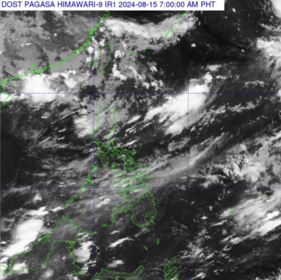
The low pressure area near the East Sea is forecast to strengthen into a tropical depression and cause rain in the Philippines.
The latest storm and tropical depression information from the Philippine Atmospheric Geophysical and Astronomical Services Administration (PAGASA) on August 15 said that the low pressure area (LPA) detected off the coast of Northern Luzon, Philippines is likely to strengthen into a tropical depression in the next 24 hours but may also quickly leave the Philippine forecast area.
According to the latest storm and tropical depression information, the low pressure area near the East Sea is about 1,375km east of Northern Luzon, currently inside the Philippine forecast area.
PAGASA weather forecaster Robert Badrina said the low pressure area is expected to be named “Dindo”.
For now, the PAGASA weather forecaster said the low pressure area near the South China Sea has no direct impact on the Philippines and the rainfall being recorded in some parts of the country is due to the southwest monsoon or “habagat”.
“Habagat is causing scattered and isolated showers and thunderstorms in many areas, including Metro Manila, the rest of Luzon and Western Visayas,” Badrina said in a 5 a.m. alert on August 15, the Manila Times reported.
According to the latest weather forecast from PAGASA, the remaining areas of the Philippines will record partly cloudy or partly cloudy skies due to localized thunderstorms.
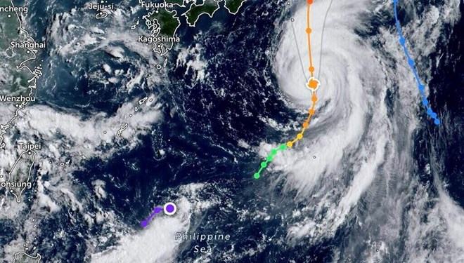
Also related to the storm developments near the East Sea, the latest storm information from the Joint Typhoon Warning Center (JTWC) of the US Air Force and US Navy said that Ampil, the seventh storm of the western Pacific typhoon season, is 867km south of Yokosuka, Japan.
The storm has been moving north-northeast at a speed of 17 km/h over the past 6 hours. The latest storm forecast said that Ampil will continue to move north-northeast.